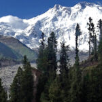
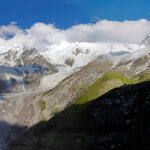
The second-highest mountain in Pakistan and ninth-highest mountain overall is Nanga Parbat (8125 m/26,813 ft), which is also regarded as one of the three most difficult mountains in the world. Lying in the mountain ranges Nanga Parbat is ranked as the ninth-highest peak in the world and the second-highest in Pakistan, with a height of 8125 meters (26,813 feet). The enormous massif is known as Nanga Parbat, which means “bare mountain,” and includes a sequence of ridges and pinnacles that culminate at an elevation of 8125 meters (26,813 feet). (Ridges and pinnacles make up the gigantic massif that culminates in the formation of the enormous mountain known as Nanga Parbat, which is 8125 meters (26,813 feet) high and is also known as the “naked mountain”). Killer Mountain is another moniker that has gained notoriety because the early catastrophes on this peak were severe and once had the maximum compared to all other mountains in the globe, the most fatalities. (Nanga Parbat is often referred to as “Killer Mountain,” getting this moniker for having hosted the most severe casualties When Hermann Buhl undertook the last ascent in a challenging 41-hour solo adventure without oxygen, a joint Austrian-German expedition ultimately succeeded in conquering it after a protracted battle.
In the program we make a circle around the mountain and witness the beauty and culture of the surrounding areas. While trekking, we cross the maximum height of 5300 meters at Mazeno, a semi technical pass, which requires fixed ropes while making the descent on steep crevassed slopes. We finish our trekking at Fairy Meadows, the given name of which really defines its meaning.
| Day | plan | Altitude | Overnight |
| 01 | After reaching Islamabad Airport, moving to hotel. Half day city tour | 500M | Hotel |
| 02 | Drive to Chilas (via Besham -12 hours & passing through Babusar Pass -10 hours) | 1265M | Hotel |
| 03 | Drive to Tato (3 hours) & trek to Fairy Meadows (3 hours) | 3300M | Alpine Hut |
| 04 | Hiking to Nanga Parbat Base Camp & back to Fair Meadows | 3900M | Alpine Hut |
| 05 | Early breakfast, hike to Tato and drive to Tarashing (7 hours) | 2250M | Hotel |
| 06 | walk to Herligkoffer Base Camp (5 hours) | 3600m | Tents |
| 07 | Hike to Shiagiri (7-8 hours) | 3650m | Tents |
| 08 | Trek to Mazeno Base Camp (4 hours) | 4200m | Tents |
| 09 | Trek to Mazeno High Camp (5-6 hours) | 4800m | Tents |
| 10 | Expedition to Upper Loiba by passing Mazeno Pass (5399m) 8-9 hours | 4500m | Tents |
| 11 | Trek to Upper Jale (4-5 hours) | 4000m | Tents |
| 12 | Trek to Jerdin (Kutgali) through Kachal (6-7 hours) | 3100m | Tents |
| 13 | Trek to Diamir Face Nanga Parbat BC (4 hours) | 4100m | Tents |
| 14 | Spare time at Nanga Parbat BC | 4100m | Tents |
| 15 | Trek to Sair (6 hours) | 3000m | Tents |
| 16 | Trek to Bunardass & drive to Chilas | 1260m | Hotel |
| 17 | Drive to Islamabad by way of Babusar Pass | Hotel | |
| 18 | Homebound Flight |


